Catalog Archive
Auction 96, Lot 191

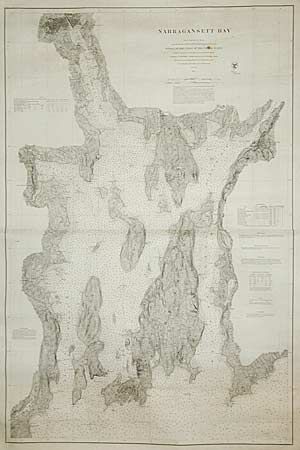
"Narragansett Bay from a Trigonometrical Survey under the Direction of Benjamin Pierce Superintendent…", U.S. Coast Survey
Subject: Rhode Island

Period: 1873 (dated)

Publication:

Color: Black & White

Size:
30 x 45.5 inches
76.2 x 115.6 cm
Download High Resolution Image
(or just click on image to launch the Zoom viewer)

Extremely scarce original navigation chart issued by the Coast Survey. It covers the bay and coastlines with incredible detail showing soundings, navigation hazards, shoals, buoys, lighthouses, etc. City plans of Newport, Wickford, East Greenwich, Bristol, Fall River, Warren and Providence are all included. Printed on very sturdy paper for use on board ship.

References:

Condition: A

There are a couple of spots of foxing and some chipping in the wide margins, but overall extremely good condition for a working sailing chart.

Estimate: $450 - $500

Sold for: $250

Closed on 9/12/2001

Archived