Catalog Archive
Auction 96, Lot 165
"Map of Illinois", Matthews-Northrup Co
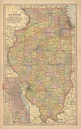
Subject: Illinois
Period: 1898 (dated)
Publication:
Color: Printed Color
Size:
12 x 19.9 inches
30.5 x 50.5 cm
Download High Resolution Image
(or just click on image to launch the Zoom viewer)
(or just click on image to launch the Zoom viewer)