Subject: New England
Period: 1850 (circa)
Publication:
Color: Black & White
Size:
14 x 17.5 inches
35.6 x 44.5 cm
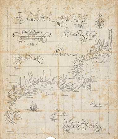
This is a 19th century lithograph facsimile of one of the most important New England maps of the 17th century. It originally appeared in Dudley's Dell' Arcano del Mare, the first sea atlas to use the Mercator projection and the first atlas published by an Englishman (1646). This example purportedly comes from a book titled "History of New York" published around 1850. The map is a very close copy of the original, lacking the last line of the title and some small islands and place names. It is very interesting and decorative with a large compass rose, a sailing ship and extensive calligraphy. As the original map is extremely rare and sells in excess of $10,000, this 19th century example is a great map for decorative purposes.
References:
Condition: C
Printed on thin paper, issued folded and now flattened. Extensive scattered foxing with a small tear into map at bottom, repaired with archival tape.