Catalog Archive
Auction 96, Lot 121

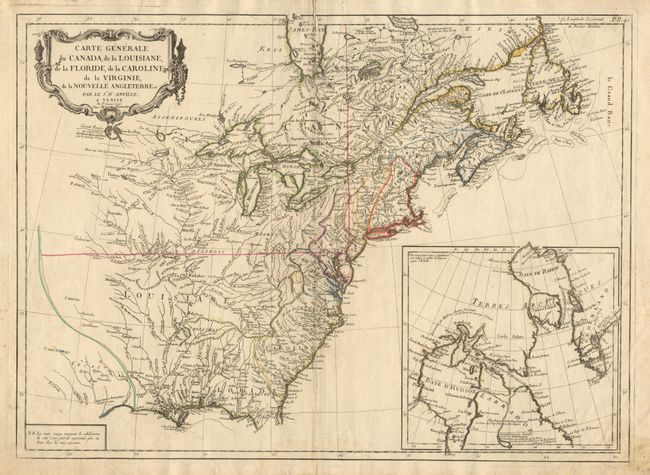
"Carte Generale du Canada, de la Louisiane, de la Floride, de la Caroline, de la Virginie, de la Nouvelle Angleterre etc. par le Sr. d'Anville", D'Anville/Santini
Subject: Colonial North America

Period: 1776 (dated)

Publication:

Color: Hand Color

Size:
25.7 x 18.8 inches
65.3 x 47.8 cm
Download High Resolution Image
(or just click on image to launch the Zoom viewer)

Uncommon copper engraved map based on the cartography of D'Anville in the first year of the American Revolution. Large inset of northeastern Canada and Greenland. A great amount of detail throughout, especially in the Mississippi and Missouri river area. West of Lake Superior is a lake and river system with a notation indicating the possibility of a Northwest Passage. The large, decorative title cartouche is uncolored as issued.

References: McCorkle #776.3; Sellers & Van Ee #136.

Condition: A

Beautifully engraved on thick hand-laid paper with watermark. Short split at top and bottom centerfold with no loss. Some foxing in margins.

Estimate: $600 - $800

Sold for: $850

Closed on 9/12/2001

Archived