Catalog Archive
Auction 96, Lot 114

"An Accurate Map of the British Empire in Nth. America as settled by the Preliminaries in 1762", Gibson, John

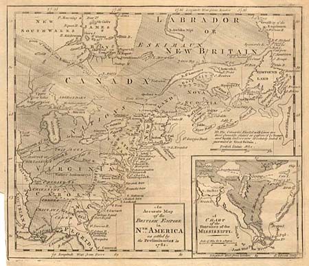
Subject: Colonial United States and Canada

Period: 1765 (circa)

Publication: Gentleman's Magazine

Color: Black & White

Size:
9.6 x 8.2 inches
24.4 x 20.8 cm
Download High Resolution Image
(or just click on image to launch the Zoom viewer)

Copper engraved map covering from Labrador to Florida and over to the Mississippi. The map graphically depicts "The Countries shaded with lines are those formerly claimed or possessed by France and Spain and are now absolutely ceded & guaranted [sic] to Great Britain." The colonies of Virginia and Carolina are now shown with their western boundaries on the Mississippi. The Six Nations with their western boundary are shown occupying the Great Lakes region. Large inset "A Chart of the Entrance of the Mississippi" provides a detailed view of the vicinity of New Orleans.

References: Jolly GENT-165; McKorkle #762.1; Seller & Van Ee #92.

Condition: A

Folded, as issued and lightly toned along one fold. Close trimmed at binders edge, as issued.

Estimate: $200 - $250

Sold for: $200

Closed on 9/12/2001

Archived