Subject: Colonial America
Period: 1587 (published)
Publication: Theatrum Orbis Terrarum
Color: Hand Color
Size:
18.2 x 13.2 inches
46.2 x 33.5 cm
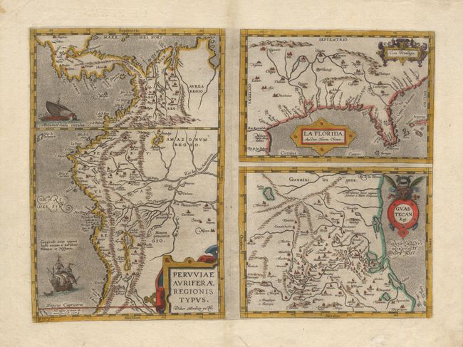
One of the very few 16th century maps based on Spanish sources; in this case drawn from reports of Hernando de Soto's expedition through the region. There are three maps on this sheet. The most important map (La Florida) is the first printed map of the southeastern portion of the United States. This influential map provided the foundation cartography for the region, particularly in the depiction of the river system. The second map (Guastecan Reg) combines with "La Florida" to extend the coastline of the Gulf of Mexico further south. The third is a map of Peru, where de Soto was the first Spaniard to meet Inca Emperor Atahuallpa. From a French edition.
References: Burden #57 and van den Broecke #15.
Condition: A
A crisp impression with attractive later coloring.