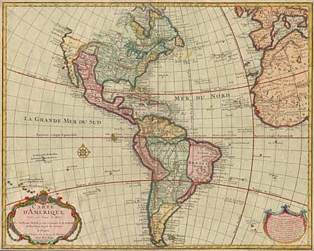
Subject: Western Hemisphere
Period: 1745 (dated)
Publication:
Color: Hand Color
Size:
24 x 19 inches
61 x 48.3 cm
First issued by De l'Isle in 1722 and one of the most popular maps of the 18th Century. This is the fifth state of the map, unchanged geographically from the original, but with Philippe Buache's imprint at bottom right. The map illustrates French dominance in North America with the British colonies squeezed onto the eastern seaboard. Numerous Indian names are shown throughout. Garland draped title cartouche an 'Avertissement' cartouche and a compass rose decorate the map. Closely trimmed on all sides, just adequate for framing.
References: Tooley (America) #5, pg. 13.
Condition: B
Later color with a faint damp stain lower left. Closely trimmed on all sides, just adequate for framing.


