Catalog Archive
Auction 95, Lot 287

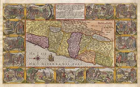
"Tabula Geographica, In Qua Omnes Regiones, urbes, oppida, loca et fluvij Israeliae descri…", Plancius, Petrus
Subject: Holy Land

Period: 1620 (circa)

Publication:

Color: Hand Color

Size:
19.5 x 11.5 inches
49.5 x 29.2 cm
Download High Resolution Image
(or just click on image to launch the Zoom viewer)

A supremely graphic map from a Dutch Bible depicting the land of Canaan. The map is surrounded by fourteen vignettes containing Biblical scenes, including Samson slaying the Philistines with the jawbone of an ass, David and Goliath, and the golden calf.

References:

Condition: A

Expert extension of side margins with superb facsimile of between 1/8" and 1/4" of engraving.

Estimate: $1,400 - $1,500

Sold for: $800

Closed on 6/13/2001

Archived