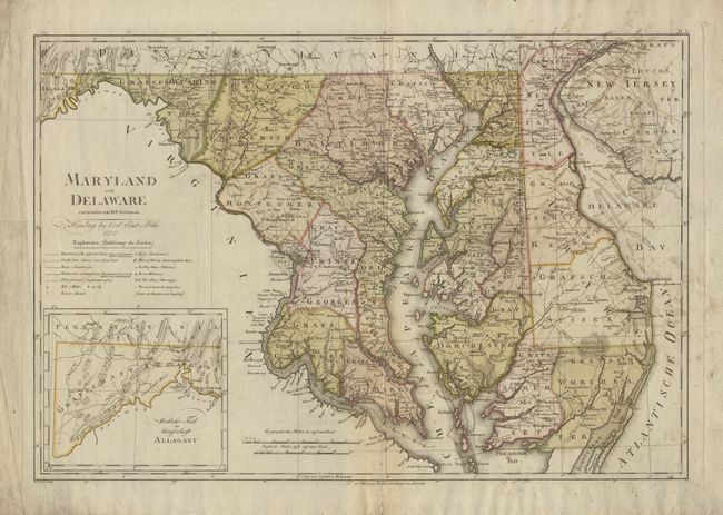
Subject: Maryland and Delaware
Period: 1797 (dated)
Publication: Atlas von Nordamerika
Color: Hand Color
Size:
17.2 x 25.2 inches
43.7 x 64 cm
This was one of the ten maps completed by Sotzman for Christoph Ebeling's planned atlas of the United States, which was published by Carl Ernst Bohn. These were among the best available maps at the time in terms of scale and level of detail. It provides incredible detail including the location of mills, churches, taverns and even the names of individual land owners. The newly created District of Columbia is shown with its original boundaries. The western part of Maryland is included in a large inset. Ristow notes that these maps "are among the rarest of cartographic Americana for the closing decade of the eighteenth century".
References: Ristow p. 169-178.
Condition: B
Light scattered soiling and tissue repairs along centerfold. Still a nice example of this very scarce map.