Subject: Atlas
Period: 1862 (dated)
Publication:
Color: Hand Color
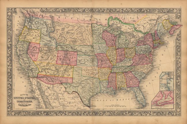
Complete atlas with 80 maps and plans on 50 sheets, each surrounded by the 1st edition floral border and dated 1860. Twenty-six of the sheets are related to the United States with individual states, regions and city plans. Two world maps. This edition shows the Confederate Territory of Arizona below New Mexico Territory, the L-shaped Washington, Dakota Territory extending to Washington at the continental divide, and Nebraska Territory extending to the corner of Utah Territory. Small folio, publisher's 1/2 morocco, extremities rubbed. Spine is partially missing and front cover a bit loose. Maps are lightly toned with little sign of foxing and no splits or tears, and beautiful bright coloring. First few signatures are shaken. All pages including endpapers are present and maps correctly collate to list of maps
References:
Condition: B
A nice example of this desirable mid-nineteenth century atlas.