Catalog Archive
Auction 94, Lot 180

"Culiacanae, Americae Regionis Descriptio [on sheet with] Hispanoliae, Cubae, Aliarumque Insularum Circumiacientium, Delineato", Ortelius, Abraham
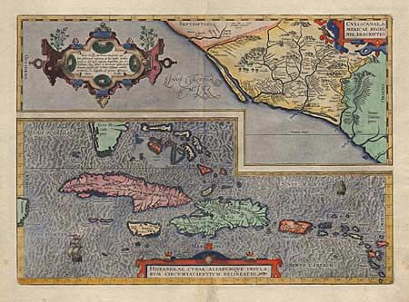
Subject: Mexico and the Caribbean

Period: 1592 (circa)

Publication: Theatrum Orbis Terrarum

Color: Hand Color

Size:
19.8 x 14 inches
50.3 x 35.6 cm
Download High Resolution Image
(or just click on image to launch the Zoom viewer)

Two great maps within one border; the first covers the region of western Mexico around Culiacan and the second is of the Greater Antilles. This important map is the first detailed map of the Caribbean and one of the first to detail western Mexico. Includes an interesting error in that the Tropic of Capricorn is shown on the Mexican map where the Tropic of Cancer should be. Three strapwork cartouches and sailing ships decorate the map. Latin text on verso with the page #8 indicating it was published between 1592 and 1612. $1300 RESERVE.

References: Van den Broecke #14.

Condition: A

Short fold separation in bottom margin.

Estimate: $1,700 - $1,800

Sold for: $1,100

Closed on 3/7/2001

Archived