Subject: Michigan
Period: 1825 (circa)
Publication:
Color: Hand Color
Size:
10.3 x 14.2 inches
26.2 x 36.1 cm
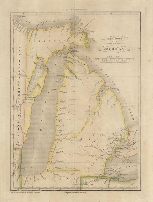
A fine early map of Michigan Territory based on the Carey and Lea. The western boundary is shown on a line 10 deg. 30' West Longitude from Washington, resulting in Green Bay and a strip of present-day Wisconsin being incorporated into Michigan. The Frontiere Indienne divides lower Michigan on a diagonal line. The only settlements shown are in the southeast, around Detroit, and Nouveaux Etablissements located on the Saginaw River. Several battles of the War of 1812 are located. Panels of French text flank the map providing a detailed history of the region with a total population of 8,496.
References: Karpinsky (FC) #98.
Condition: B
Toned with color slightly faded and a repair in top margin, still a nice example of this important map.