Catalog Archive
Auction 94, Lot 146

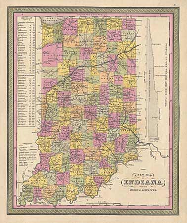
"A New Map of Indiana with its Roads & Distances", Mitchell, Samuel Augustus
Subject: Indiana

Period: 1847 (circa)

Publication: New Universal Atlas

Color: Hand Color

Size:
11.5 x 14 inches
29.2 x 35.6 cm
Download High Resolution Image
(or just click on image to launch the Zoom viewer)

A detailed and attractive map of Indiana based on Henry S. Tanner's map of the same title. It is hand-colored by county, showing roads, towns, steamship routes, railroads, proposed railroads, distances and other excellent regional details. At right is a profile of the Wabash and Erie Canal.

References:

Condition: A

Small tear in bottom margin, repaired with archival tape.

Estimate: $90 - $120

Sold for: $60

Closed on 3/7/2001

Archived