Catalog Archive
Auction 91, Lot 96

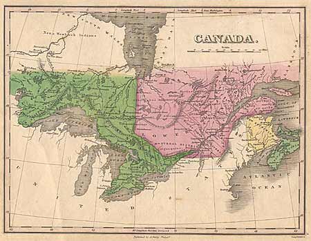
"Canada",

Subject: Canada

Period: 1826 (published)

Publication: New General Atlas

Color: Hand Color

Size:
11.1 x 8.5 inches
28.2 x 21.6 cm
Download High Resolution Image
(or just click on image to launch the Zoom viewer)

A nice map of Canada and the Great Lakes. Upper Canada includes Eastern, Johnstone, Midland, Newcastle, Home, London, and Western Districts. Lower Canada includes Gaspe, Quebec, Three Rivers, and Montreal Districts. In the United States a few Great Lakes cities and forts are noted including Ft. St. Mary, Detroit, Buffalo, and Niagara Falls. Ref: Ristow, p. 268-70. Couple of tiny faint spots, still very good. Archivally mounted.

References:

Condition: A

Estimate: $120 - $150

Sold for: $75

Closed on 6/14/2000

Archived