Catalog Archive
Auction 91, Lot 220

"Regnorum Magnae Britanniae et Hiberniae Mappa Geographica",

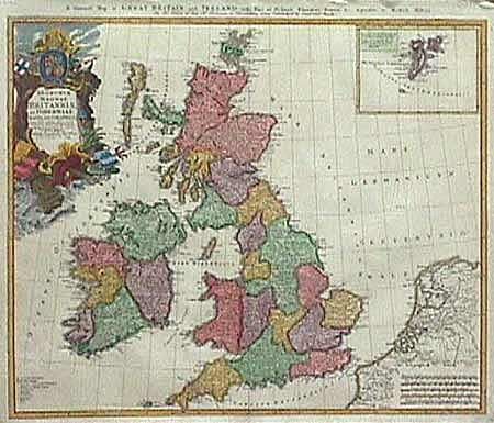
Subject: British Isles

Period: 1749 (dated)

Publication:

Color: Hand Color

Size:
21.5 x 18.5 inches
54.6 x 47 cm
Download High Resolution Image
(or just click on image to launch the Zoom viewer)

An outstanding 18th Century map of Britain with great detail and an inset of the Shetland Isles. Includes part of France, Belgium and Holland. The large, colorful title cartouche is very decorative. Nice impression and later color. Expertly backed with Japanese tissue to repair fold separation and repair one tear, now invisible.

References:

Condition: A

Estimate: $350 - $425

Sold for: $275

Closed on 6/14/2000

Archived