Catalog Archive
Auction 91, Lot 109

"Accurata delineatio celeberrimae Regionis Ludovicianae vel Gallice Louisiane ol Canadae et Floridae…",

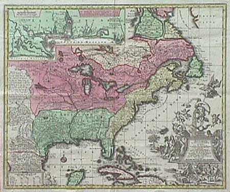
Subject: Colonial Canada and United States

Period: 1730 (published)

Publication: Atlas Novus

Color: Hand Color

Size:
19.3 x 22.3 inches
49 x 56.6 cm
Download High Resolution Image
(or just click on image to launch the Zoom viewer)

A German version of Nicolas de Fer's influential map of New France (1718) focusing on the French possessions in North America. The inset at top depicts the Mississippi River delta. The original color illustrates the colonial possessions. Seutter's large title cartouche is surrounded by depictions of explorers, cherubs and angels, and a mermaid graces the distance scales. Ref: Van Erman #28.

References:

Condition: A+

Estimate: $2,000 - $2,400

Sold for: $1,900

Closed on 6/14/2000

Archived