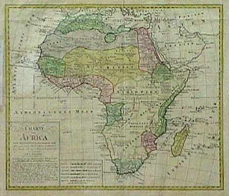
Subject: Africa
Period: 1797 (dated)
Publication:
Color: Hand Color
Size:
20.5 x 18.2 inches
52.1 x 46.2 cm
Large copper engraved map of the continent. The inscription below the title notes that the map was prepared by Franz Ludwig Gussefeld with astronomical observations and information found on the maps of Sayer, Rennel and Arrowsmith. It further states that accurate geographical knowledge of the interior will only be available after further exploration. No interior settlements are named. Despite the attempt at greater accuracy, many of the larger rivers of Central and North Africa are omitted or are depicted incorrectly. Ref: Norwich #112. Barely noticeable damp stain affecting the area of the Cape Verde Islands, overall very good.
References:
Condition: A