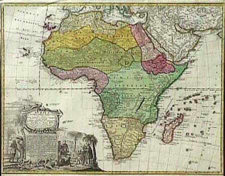
Subject: Africa
Period: 1737 (circa)
Publication:
Color: Hand Color
Size:
23 x 18.2 inches
58.4 x 46.2 cm
Johann Matthias was a professor of mathematics at Wittenberg. His large map of the continent presents a fairly accurate picture without most of the fictitious lakes and rivers of previous cartography. The Dutch settlements of Castell Batov and Stellenbosch are shown at the Cape. The most striking feature of the map is the large, uncolored, title cartouche that is bordered by elephant tusks. In the foreground is a scene of natives negotiating with European traders, surrounded by indigenous animals. In the background is a view of Table Bay and Table Mountain. Ref: Norwich #83. Trimmed to neatlines at sides, otherwise clean with attractive original color.
References:
Condition: B