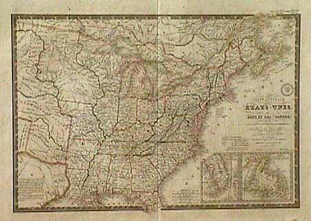
Subject: Eastern United States
Period: 1843 (dated)
Publication:
Color: Hand Color
Size:
20.2 x 14.2 inches
51.3 x 36.1 cm
Very uncommon and finely engraved map covering all the eastern United States to about the 100th Meridian, with a bit of southern Canada. The western territories include "Ter. Du Nord Ouest" encompassing present day WI & MN, a very large Iowa that takes in all the territory north of Missouri and over to the Missouri River. Missouri is also oversized and takes in part of present day Kansas up to the Missouri River. The rest of the west is designated as Indian Districts. The eastern part of Texas is shown, and is an Independent Republic. Insets of the tip of Florida and Newfoundland. Original outline color (slightly faded), on heavy paper with very wide margins and the royal seal above the script title. Damp stain in bottom margin, well outside map.
References:
Condition: A