Catalog Archive
Auction 88, Lot 72

"A New Map of the British Dominions in North America with the Limits of the Governments annexed thereto by the late Treaty of Peace, and settled by Proclamation, October 7th, 1763",

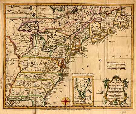
Subject: Colonial United States and Canada

Period: 1763 (dated)

Publication: The History of the War in the Annual Register

Color: Hand Color

Size:
10.2 x 13 inches
25.9 x 33 cm
Download High Resolution Image
(or just click on image to launch the Zoom viewer)

This map is a derivative of Kitchen's "A New and Accurate Map of the British Dominions in America". It depicts the lands acquired from the French in Canada, and the original thirteen colonies east of the Mississippi. It also depicts East Florida's northern boundary above the 31st parallel. The southern tip of Florida is included in an inset. Wreath style cartouche and compass rose. Folds as issued. Binders tear affecting border and fold separations with old repairs. Light tape stain on verso with new repairs with archival tape.

References:

Condition: B

Estimate: $300 - $350

Sold for: $275

Closed on 10/2/1999

Archived