Catalog Archive
Auction 88, Lot 288

"Paskaarte van't Eylant Metelino…/Golf van Constantinopolen/Tenedos/Lemnos", Doncker, Henrick
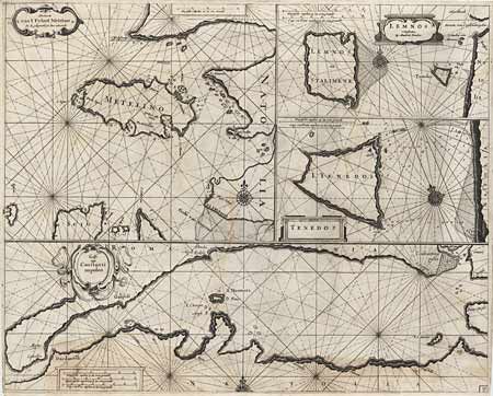
Subject: Turkey

Period: 1670 (circa)

Publication: Nieuw Groot Stuurmans Straets-Book

Color: Black & White

Size:
20 x 16.5 inches
50.8 x 41.9 cm
Download High Resolution Image
(or just click on image to launch the Zoom viewer)

Folio sheet containing four sea charts of the coast and Turkish islands. The largest covers about one third at bottom and depicts the Sea of Marmara from Constantinople to Canakkale (Dardanelli). Each map has a decorative title cartouche, compass rose and rhumb lines. Extremely dark, early impression. Trimmed close, as issued, faint toning and professional repair of fold in bottom margin. Overall fine attractive map.

References:

Condition: A

Estimate: $200 - $250

Sold for: $150

Closed on 10/2/1999

Archived