Catalog Archive
Auction 88, Lot 24

"Tabula Iteneraria ex Illustri Peutingerorum Bibliotheca …", Ortelius, Abraham

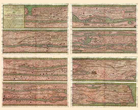
Subject: Ancient World

Period: 1619 (published)

Publication: Theatrum Geographiae Veteris

Color: Hand Color

Size:
20.2 x 15.7 inches
51.3 x 39.9 cm
Download High Resolution Image
(or just click on image to launch the Zoom viewer)

Four sheets containing eight maps (two on each sheet). This important map depicts the Roman roads throughout the known world. It begins in Bordeaux and ends in Ceylon. Hundreds of cities are included, notably Metz, Worms, Rome, Budapest, Athens, Constantinople, Jerusalem, Damascus, and Babylon. Ortelius had these maps prepared from a series of manuscript maps by Mark Welser. Ortelius died before they were completed, and they were published by Bertius. Ref: van den Broecke #227-230. Very rare, van den Broecke estimates only 17 complete sets in circulation.

References:

Condition: A

Estimate: $4,000 - $4,500

Sold for: $4,000

Closed on 10/2/1999

Archived