Current Auction
Lot 99
Current Auction

"New Found Land St. Laurens Bay, the Fishing Banks, Acadia, and Part of New Scotland", Moll, Herman

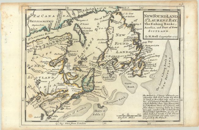
Subject: Eastern Canada

Period: 1729 (dated)

Publication: Atlas Minor...

Color: Hand Color

Size:
10.7 x 7.9 inches
27.2 x 20.1 cm
Download High Resolution Image
(or just click on image to launch the Zoom viewer)

This is the first state of Moll's map of the region surrounding the Gulf of St. Lawrence. Like Moll's other maps of this area, it appears to be based on Thornton's two maps of 1676 and 1689, in which Acadia has a triangular shape and Newfoundland has a truncated top. The map shows particularly good detail of the fishing banks and coastlines. Text at bottom right describes the fishing boundaries established by the Treaty of Utrecht. This first edition has a manuscript page 47 at upper right. Later states would include an engraved page number.

References: Kershaw #571; Shirley (BL Atlases) T.MOLL-9a #49.

Condition: B

On watermarked paper with some dampstaining at left and upper right.

Estimate: $160 - $190

Current High Bid:
$0

Reserve: Reserve Not Met
Next Bid: $80

Bid Increments
$50 - $99$5
$100 - $249$10
$250 - $499$25
$500 - $999$50
Terms & Conditions