Subject: Eastern Canada, Caribbean & Northern South America
Period: 1850 (circa)
Publication: Atlas National Illustre
Color: Hand Color
Size:
16.8 x 11.9 inches
42.7 x 30.2 cm
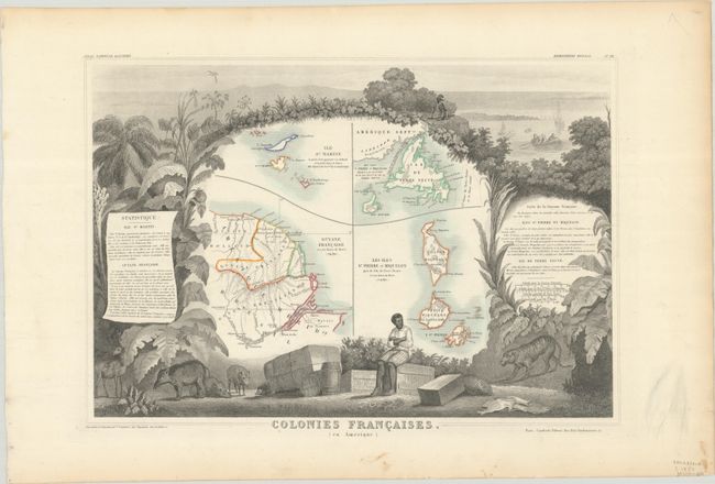
Victor Levasseur's "Atlas National Illustre" and "Atlas Universel Illustre" are among the last decorative atlases published. The maps are all lavishly illustrated with scenes of the countryside, products and activities indigenous to the region.
This highly decorative, steel engraved map includes four insets of French Colonies in the Americas. The maps depict Newfoundland, St. Pierre and Miquelon in Canada, St. Martin and Anguilla in the Caribbean, and French Guiana in South America. The maps are surrounded by beautifully engraved vignettes featuring crates and bundles of coffee and cotton, animals (such as wild boar, a porcupine, and a tiger), and tropical plants and trees.
References:
Condition: A
A nice impression with contemporary outline color on a bright sheet with light toning along the edges and some marginal soiling.