Subject: North America
Period: 1852 (dated)
Publication:
Color: Hand Color
Size:
59.1 x 56.1 inches
150.1 x 142.5 cm
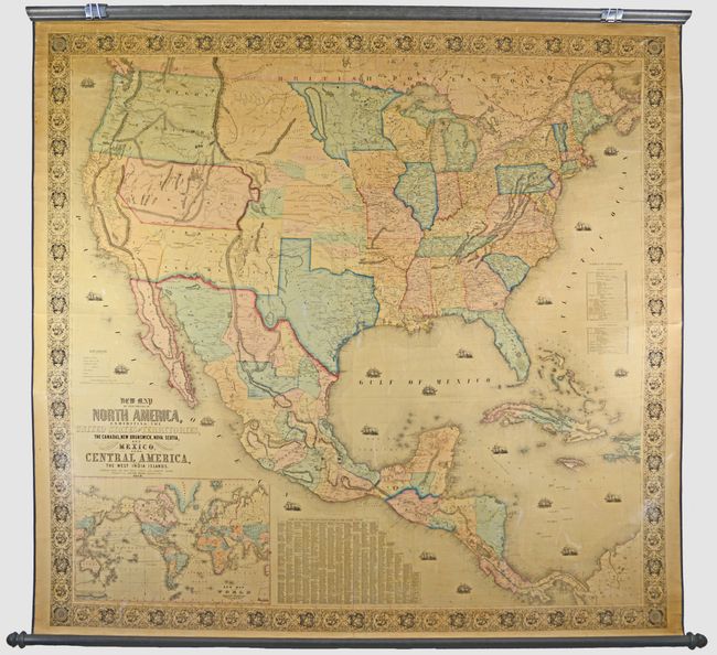
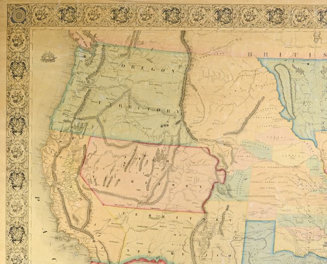
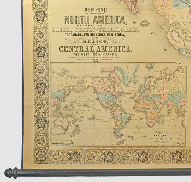
This majestic wall map was published just as the country was beginning to expand fully to the Pacific following the land gains after the Mexican War. The gold region in California is remarkably inaccurate with Auburn shown well north of Sacramento City and lying between it and the Marysville/Yuba City area. The Great Basin area is also inaccurate and roughly follows the Fremont model. The middle of the country is occupied by the newly organized Kanzas Territory and Nebraska Territory, which stretches from the Missouri River to the Continental Divide. The map features very large, early configurations of Washington, Oregon, Utah and New Mexico territories, and Indian Territory is composed of three named areas: Chah-Lahkee, Moscogee and Chahta. This edition also depicts the boundary line of the proposed Gadsden Purchase in present-day southern Arizona. The map is filled with wagon routes, explorer's trails, forts, Native American tribes, and much more. Surrounding the main map image is a table of distances, a table of United States counties, and a large inset of the world on Mercator's projection. This spectacular wall map is embellished with decorative borders and numerous engraved sailing ships and steamships in the oceans. Printed and published by Hoen & Company, Baltimore. Original linen backing and rollers present and intact.
References: cf. Wheat (TMW) #794; cf. Wheat (GOLD) 243.
Condition: B+
A nice impression with toning that is much lighter than most examples, small spots of foxing, and some soiling and abrasions. There are a few short cracks along the edges, with one crack at top that extends less than 2" into the decorative border and has been repaired on verso with archival tape. The original rollers are in very good condition. A lovely example that is ready for hanging.