Subject: Western Hemisphere - America
Period: 1856 (dated)
Publication:
Color: Hand Color
Size:
28 x 20.1 inches
71.1 x 51.1 cm
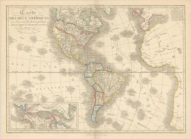
This uncommon, large map traces the routes of Cook and La Perouse and includes interesting geography in northern North America. An inset map at bottom left depicts a Northwest Passage from the Davis Strait, through the Arctic Sea, and to the Pacific Ocean via the Entree de Norton, which bisects Amerique Russe (Alaska) and Terre de Kiteguen, the latter of which is attached to Greenland. The depiction of the United States is also outdated, as the entire Southwest is still shown as part of Mexico, despite the Treaty of Guadalupe Hidalgo having been signed 8 years prior to the publication of this map. Numerous Native American tribes are noted within North America, and the Rocky Mountains appear to radiate out from a central point in present-day Wyoming. Although the map extends to show part of Europe and Africa, they are left largely blank.
References:
Condition: B+
Contemporary outline color on a sheet with minor toning along the centerfold and a few spots of soiling. Short centerfold separations at top and bottom have been closed on verso with archival tape.