Subject: Western Hemisphere - America
Period: 1764 (dated)
Publication:
Color: Hand Color
Size:
13.3 x 12 inches
33.8 x 30.5 cm
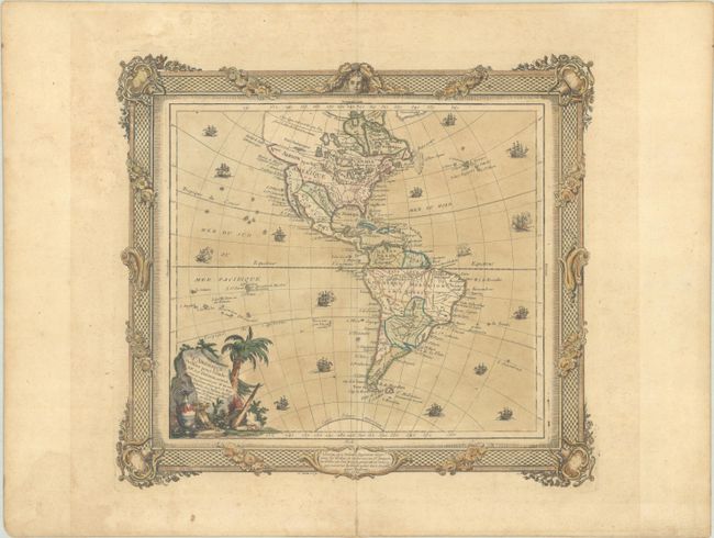
This decorative map features a landscape-style title cartouche and several sailing ships. While the interior of the map contains little cartographic information, the northwest part of North America is quite interesting. A large bay labeled, Entrée de Martin d’Aguilar en 1603 indents the coastline, while above that, a river and lake system provide a complex Northwest Passage. There is a notation that the existence of a Sea of the West is questionable just above this fictitious passage. The map is surrounded by an elaborate border printed from a separate plate. Brion was the former Geographer to the King of France, and Desnos was Geographer to the King of Denmark.
References: McGuirk #130.
Condition: B+
On watermarked paper with light toning, minor foxing, and short archivally repaired centerfold separations in the top and bottom blank margins.