Catalog Archive
Auction 206, Lot 643

"Nieuwe Pascaart voor een Gedeelte van de Zeekusten van Barbaria Beginnende van C: Rusato tot Alexandria als Mede t' Meeste Gedeelte van t' Eylandt Candia", Keulen, Johannes van

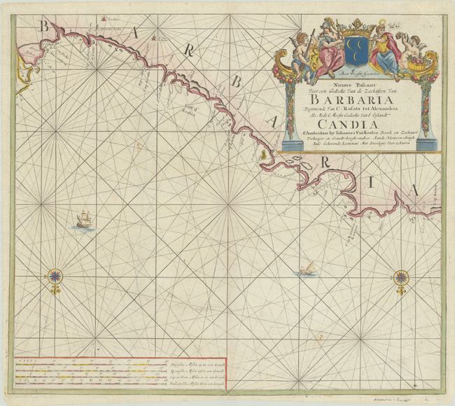
Subject: Northern Africa

Period: 1720 (circa)

Publication:

Color: Hand Color

Size:
22.8 x 19.9 inches
57.9 x 50.5 cm
Download High Resolution Image
(or just click on image to launch the Zoom viewer)

Interesting sea chart of portions of the Libyan and Egyptian coasts from Cap Rusato (Darnah) to Alexandria. It is embellished with rhumb lines throughout and is oriented with north and the Mediterranean at the bottom. Decorated with two compass roses, a sailing ship and a galley ship. A large title cartouche, surmounted by figures and the coat of arms of the Barbary Corsairs, dominates the upper-right quadrant. This is the third state, with the plate number "XVIII" removed.

References: Koeman, Van Keulen [173]**; Phillips (Atlases) #3444-17 (Volume 2).

Condition: A

A crisp impression on a bright sheet with a "E V Oorspronk" watermark and a couple of minor spots.

Estimate: $240 - $300

Unsold

Closed on 11/12/2025

Archived