Subject: Africa
Period: 1680 (published)
Publication: Geography Rectified
Color: Hand Color
Size:
5.3 x 4.5 inches
13.5 x 11.4 cm
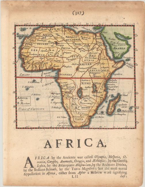
This small map was issued in the first edition of Morden's uncommon miniature world atlas. The geography is based on French sources and appears to primarily follow Alexis-Hubert Jaillot's map of 1674. The source of the Nile is shown emanating from two lakes below the equator. Morden follow's Jaillot's depiction of the rivers south of these Ptolemaic lakes, with the Zambeze River and Zambere Rivers (here unnamed) and Rio de Spiritu Santo flowing into the Indian Ocean. This is the first state, with the longitude based on a London prime meridian, which was updated to Tenerife for the 1688 edition. On a sheet of English text measuring 6.0 x 7.8".
References: Betz #125; King (3rd ed.) #1680; Shirley (BL Atlases) T.MORD-2a #38.
Condition: B+
A nice impression on a lightly toned sheet with heavier toning along the edges of the sheet.