Subject: Southern Asia
Period: 1486 (published)
Publication: Cosmographia
Color: Hand Color
Size:
21.8 x 15.8 inches
55.4 x 40.1 cm
Claudius Ptolemy was a mathematician, astronomer and geographer who worked in Alexandria, then a part of the Roman Empire, in the 2nd century AD. One of the most learned and influential men of his time, his theories dominated both astronomy and geography for nearly 1500 years. His writings were kept alive by Arabic scholars during the Middle Ages and reemerged in Europe during the Renaissance. The birth of printing led to wide dissemination of his great works on astronomy and geography. There were a number of editions of his Geographia beginning in 1477. These early editions contained maps based on his original writings, known as Ptolemaic maps. As geographic knowledge increased with the explorations of Columbus, Magellan, Cabot and others, maps of the New World were added, and maps of the Old World were revised. Ptolemy's Geographia continued to be revised and published by some of the most important cartographers including Martin Waldseemuller, Sebastian Munster, Giacomo Gastaldi, Jodocus Hondius, and Gerard Mercator (whose last edition was published in 1730).
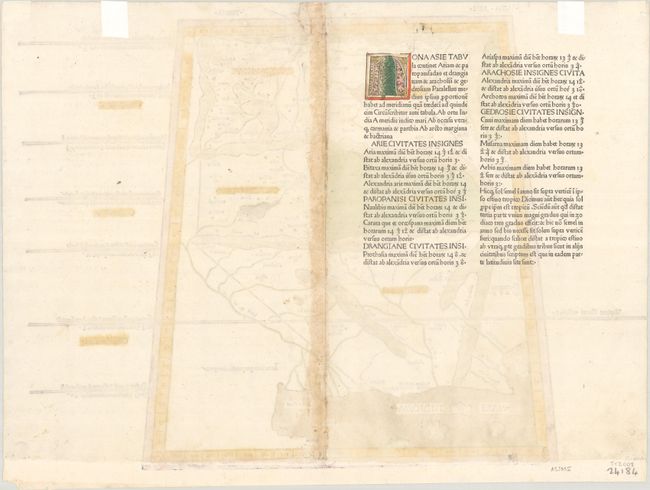
This striking woodblock map provides a Ptolemaic view of the region of present-day Pakistan, Afghanistan and northern India within a trapezoidal border. The historic regions of Gedrosia, Drangia, Aria, Paropanisus, and Arachosia are prominently located with their rope-like mountainous boundaries. Latin text on verso.
This rare woodcut map was published in the 1486 Ulm edition of Ptolemy's Cosmographia, using the same woodcuts and text as the first edition in 1482. The 1482 edition was printed by Leinhart Holle with text that was based on a Latin translation by Jacobus Angelus and edited by Nicolaus Germanus, a Benedictine monk and cartographer. In addition to editing Jacobus Angelus' translation, Nicolaus Germanus also corrected and improved the maps. It is believed that the maps were engraved by Johannes, an engraver from Armsheim, as his imprint appears on the world map. Leinhart Holle went bankrupt shortly after the publication and sold the blocks to Johann Reger, who printed a second edition in 1486. The two editions are distinguishable as titles were added to the majority of the maps on recto, whereas the titles only appear on verso in the 1482 edition. In addition, the 1482 edition is identifiable due to the coloring of the maps, on which the seas were colored in a vibrant blue made from Lapis Lazuli; in the 1486 edition, the seas were colored brown. According to Nordenskiold, the 1486 edition of the atlas is significantly rarer than its predecessor.
References: Mickwitz & Miekkavaara #200-29; Nordenskiold (Facsimile Atlas) pp. 14-16.
Condition: B+
A nice impression with original color on a bright sheet with light damp staining along the centerfold, as well as some abrasions along the centerfold. Professionally remargined at bottom with most of the bottom neatline replaced in facsimile (and color added to the new portion of the border). There is a professionally repaired tear that enters less than 1/2" into the image at top, and remnants of hinge tape on verso.