Subject: Bay of Nilwella, Sri Lanka
Period: 1753 (circa)
Publication: Zee-Fakkel, Part VI
Color: Hand Color
Size:
10.5 x 9.6 inches
26.7 x 24.4 cm
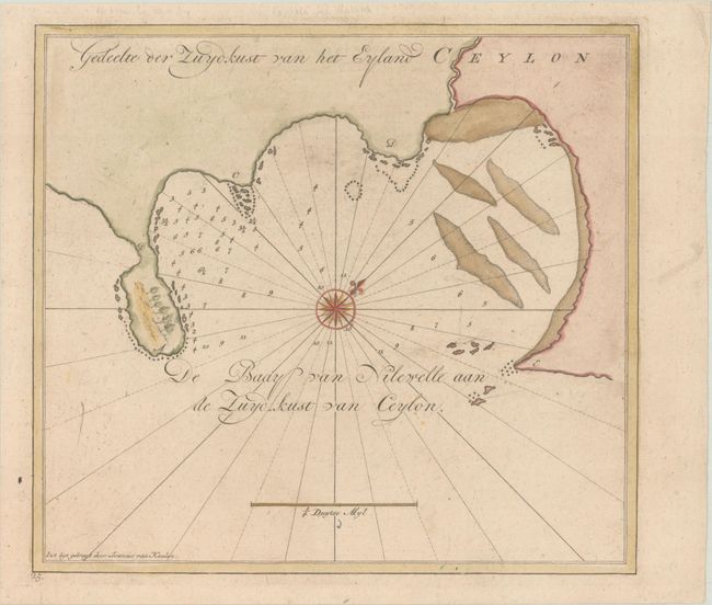
This chart depicts the bay surrounding Nilwella on the southern coast of Sri Lanka. The chart shows depth soundings, rocks and shaols, and is adorned with a compass rose orienting north to the top right of the sheet. Sri Lanka was an important location for Europeans in the spice trade, both for its cinnamon and tea, as well as its strategic location as a stopping point on the way to the East Indies. This chart was published in Volume VI of Van Keulen's Zee-Fakkel, which was considered to be the "Secret Atlas of the V.O.C."
References: Koeman, Keu 135 B (30).
Condition: B+
A nice impression on a faintly toned sheet with a "GWP" watermark and very light soiling.