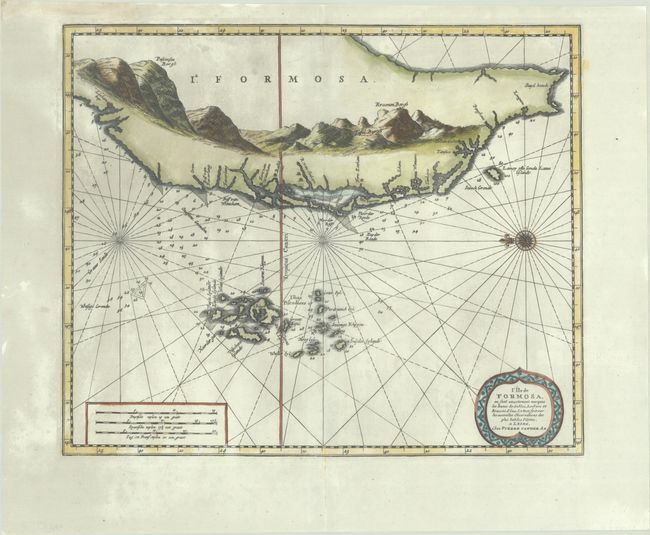
Subject: Taiwan
Period: 1720 (circa)
Publication: Galerie Agreable du Monde
Color: Hand Color
Size:
13.6 x 11.3 inches
34.5 x 28.7 cm
This is one of the earliest, obtainable maps to focus on Taiwan. Oriented with north to the left, the map shows the southwestern portion of the island, as well as the adjacent Penghu Islands (Ilhas Piscadores). The detail is limited to a few place names along the coast and anchorages, shoals, and depth soundings in the surrounding waters. The interior of the island is filled with a large panoramic view of a mountain range.
References:
Condition: B
A dark impression on a bright sheet with the watermarks of a fleur-de-lis and "IV," some printer's ink residue, and minor soiling. There are professional repairs to centerfold separations at top and bottom and to several chips along the edges of the sheet, including one that just passes the neatline at top left, with a minor amount of the neatline replaced in facsimile. The map was deaccessioned from Brooklyn Public Library, and the old perforated stamp has been professionally infilled, and is still faintly visible at far right above the title cartouche.