Subject: Asia
Period: 1749 (dated)
Publication:
Color: Hand Color
Size:
25.6 x 19.4 inches
65 x 49.3 cm
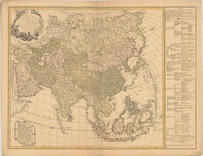
This is the uncommon first state of this terrific map of the continent. Gilles Robert de Vaugondy succeeded his uncle, Pierre Moulard Sanson, and thus based many of his maps, including this one, on the large volume of accumulated records of the Sanson family. It is an intricately engraved map with plenty of place names and topographical detail. Terre de Jedso (Hokkaido) is depicted as a peninsula attached to the mainland. There are six unlabeled islands west of the Mariana Islands. The map includes a group of islands labeled Nouvelles Philippines to the east of the actual Philippines. A stretch of coast north of Western New Guinea is identified as Terre elevee. East of Kamchatka, there is another partial coastline with a note that reads, "Terre vue en 1741 par M. Tchirikow." The decorative title cartouche, engraved by Gobin, depicts a mythical bird and a female figure reclining in the shade with a camel. Eight distance scales are enclosed in an ornate cartouche at bottom left. A panel of French text at right provides information about political divisions.
References: Pedley #373.
Condition: B+
A crisp impression with full contemporary color on a lightly toned sheet with the watermark of a Maltese cross encircled in rosary beads. There are short printer's creases at top and bottom, a paper flaw and small stain in the text panel at top, and an archivally repaired centerfold separation at top.