Subject: Eastern Europe, Belarus
Period: 1776 (dated)
Publication:
Color: Hand Color
Size:
17.4 x 21.8 inches
44.2 x 55.4 cm
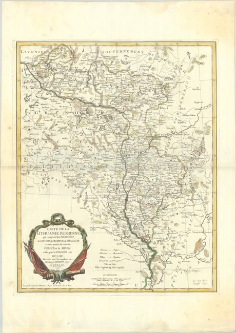
This finely detailed map is copied from the Homann Heirs's Charte von Russisch Litauen..., published just a year earlier. Centered on present-day Belarus, the map spans from Vilnius east to Smolensk, and from Opochka south to Kyiv. It was published in the aftermath of the First Partition of the Polish-Lithuanian Commonwealth (1772) and focuses on "Russian Lithuania," the lands ceded to Russia in the partition. The various political divisions are labeled and carefully delineated. A key in Latin and French identifies hamlets, monasteries, villages, towns and cities, and capital cities. The strapwork title cartouche has a militaristic theme. Published in Venice.
References:
Condition: A
A sharp impression with contemporary outline color and later color in the cartouche, on a bright sheet with the watermarks of "A S" and three crescent moons. There are light damp stains and minor soiling confined to the edges of the sheet.