Subject: Central Europe
Period: 1730 (circa)
Publication: Atlas Mapparum Geographicarum Generalium...
Color: Hand Color
Size:
22.9 x 18.4 inches
58.2 x 46.7 cm
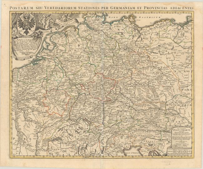
This remarkable map provides a look at the early, extensive postal system in the early 18th century per the postmaster, Johann Peter Nell. It centers on Nuremberg and spans from Calais to Krakow, and from the Baltic to Vienna, throughout emphasizing the post roads that linked the majors cities of Europe. A legend identifies the different types of routes and stops. The map is embellished with two cartouches, including a decorative dedicatory cartouche at top left featuring a cherub riding Pegasus and a striking coat of arms. An alternative Latin title runs above the neatline: Postarum seu Veredariorum Stationes per Germaniam et Provincias Adiacentes.
References:
Condition: A
A crisp impression on a watermarked sheet with a short repaired centerfold separation at bottom. There is a printer's crease entering the top left border and a few light dampstains in the top blank margin.