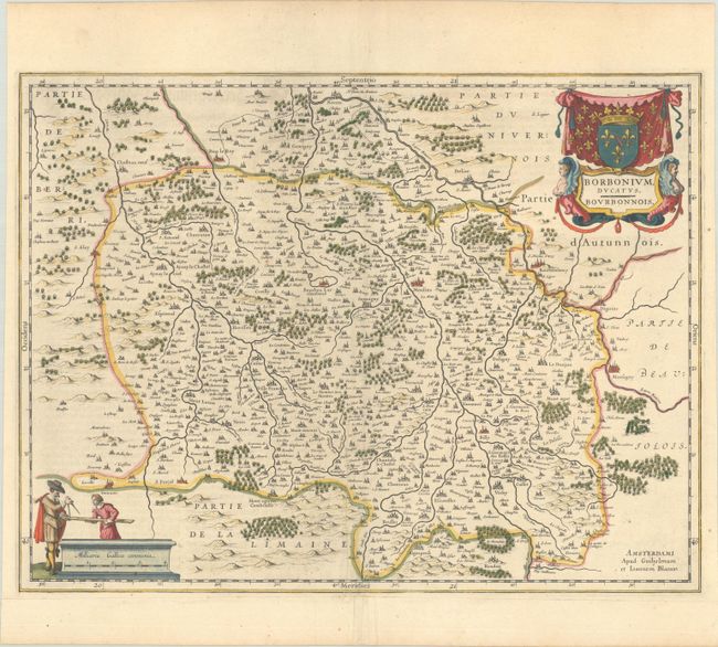
Subject: Central France
Period: 1641 (circa)
Publication: Novus Atlas
Color: Hand Color
Size:
19.6 x 14.9 inches
49.8 x 37.8 cm
A fine map of the Bourbonnais Province in central France with nice detail of cities, villages and forests. The Loire River flows through the upper corner of the map, past Bourbon-Lancy, Marsigny and many other towns. The map extends to include Nevers in the north, Vichy in the south, and Montluçon in the west. It is decorated with two beautiful cartouches featuring the coat of arms of the House of Bourbon-Condé, a pair of figureheads, and surveyors. German text on verso, published between 1641-49.
References: Van der Krogt (Vol. II) #4850:2.
Condition: A
A crisp impression with full contemporary color on a bright sheet with a printer's crease adjacent to the centerfold and minor toning along the edges of the sheet.