Subject: South Pole
Period: 1666 (published)
Publication: Atlas Contractus
Color: Hand Color
Size:
19.4 x 17.3 inches
49.3 x 43.9 cm
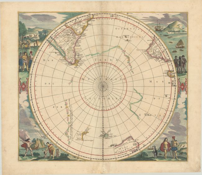
This early map of the south pole is considered one of the earliest realistic maps of the Antarctic continent, which is partially delineated in a combination of coastline and strings of islands noted as first discovered by Magellan. The circular map also shows parts of South America, Africa and Madagascar with the incomplete coastline of Australia. When first published in 1637, this was the first printed map to show the discovery of Peter Nuyts land and was the best map of Australia prior to Tasman's discoveries. Other early Dutch explorations in the region are also noted. The map is surrounded by fabulous engravings of natives and early explorers. This is the fourth state, in which the title cartouche has been removed to make room for the new discoveries of New Zealand and Tasmania. This is also the only edition to name Nova Hollandia, and the Islands of Amsterdam and Paulo have also been added. Blank verso.
References: Tooley (Australia) p. 198, #10; Tooley (MCC-2) #24; Van der Krogt (Vol. I) #0030:1.4.
Condition: B+
A sharp impression with full contemporary color, light soiling, and toning along the centerfold. There are archival repairs to separations along the centerfold and to a 1/2" tear in the decorative surround (just above South America).