Catalog Archive
Auction 206, Lot 456
"[On 3 Sheets] Cursus Rheni a Basilea Usque ad Bonnam, III. Sectionibus Exhibitus a Domino G. de l'Isle...", Homann Heirs
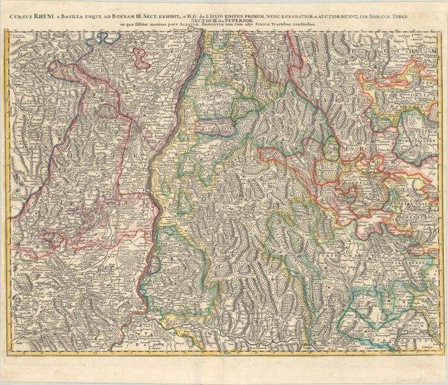

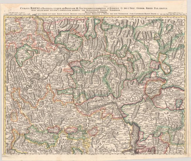
Subject: Western Europe, Rhine River
Period: 1760 (circa)
Publication: Atlas Mapparum Geographicarum Generalium...
Color: Hand Color
Size:
23.9 x 18.6 inches
60.7 x 47.2 cm
Download High Resolution Image
(or just click on image to launch the Zoom viewer)
(or just click on image to launch the Zoom viewer)