Subject: Baltic, Latvia
Period: 1747 (dated)
Publication:
Color: Hand Color
Size:
13.8 x 19.3 inches
35.1 x 49 cm
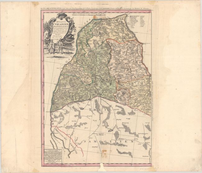
This is the western sheet of the Homann Heirs' terrific two-sheet map of Latvia and northern Lithuania. The map shows the Duchy of Courland, spanning from the Baltic coast east to the Lielupe River, and from Cape Kolka south to Memel (Klaipeda). It identifies several towns and cities, including Libau (Liepaja) and Mitau (Jelgava). Political divisions, rivers, lakes, and forests are also located. A key identifies various types of towns and cities and a Sunday prayer in the now-extinct Curonian language appears at bottom left. The ornate cartouche at top left features two figures in local dress. Cartography is credited to Johann Christoph Barnickel. An alternate French title appears above the neatline: Le Duche de Courlande...
References:
Condition: B
Full contemporary color on watermarked paper with light staining along the upper and lower centerfold, minor extraneous creasing adjacent to the centerfold, and old tape stains in the margins. There is a chip at bottom with a 0.5" x 0.5" loss to border that has been backed with linen hinge tape on verso.