Subject: Eastern Hemisphere
Period: 1720 (circa)
Publication: Descriptio Orbis Antiqui in XLIV. Tabulis...
Color: Hand Color
Size:
13.4 x 13.1 inches
34 x 33.3 cm
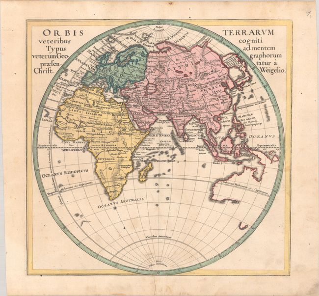
This attractive map of the Eastern Hemisphere shows the Prime Meridian running through the Canary Islands, the furthest western point according to Ptolemy. The map identifies ancient regions and cities throughout Europe, Asia, and Africa, but the overall cartography is up-to-date. Japan is joined with a large island labeled Terra Incognita, and Australia is beginning to take shape with Tasman's discoveries in the region. Likely engraved by Michael Kauffer.
References: Shirley (BL Atlases) T.WEIG-2a #1.
Condition: B+
A nice impression on thick, watermarked paper with light foxing, minor soiling, and an archivally repaired edge tear that enters 1.25" into map image at bottom. A light dampstain at bottom right just enters the border.