Subject: London, England
Period: 1855 (circa)
Publication:
Color: Hand Color
Size:
25.5 x 17.9 inches
64.8 x 45.5 cm
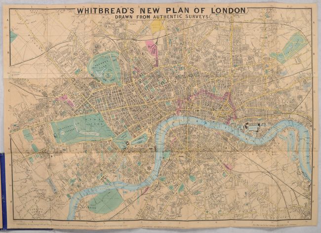
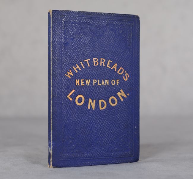
This folding tourist map extends from Kentish Town south to Denmark Hill and from Kensall Green east to Rotherhith. The River Thames runs across the center of the map with parks (green), cemeteries (gray), roads (yellow) and train stations (red) all identified and colored. The map is precisely engraved down to individual buildings, and is accompanied by a 32-page index "containing references to 2,800 streets, squares, &c., 7,500 cab fares, and a list of the principal exhibitions and places of amusement." Published by J. Whitbread in London. Hardbound in blue cloth (4.2 x 6.4") with gilt title on the front cover.
References:
Condition: B+
Issued folding and backed with contemporary linen. There is light toning, faint offsetting, and a few minor spots at top. Accompanying text is lightly toned and detached. Covers are lightly soiled and worn.