Subject: London, England
Period: 1755 (dated)
Publication: Maitland's History and Survey of London
Color: Hand Color
Size:
18.4 x 14 inches
46.7 x 35.6 cm
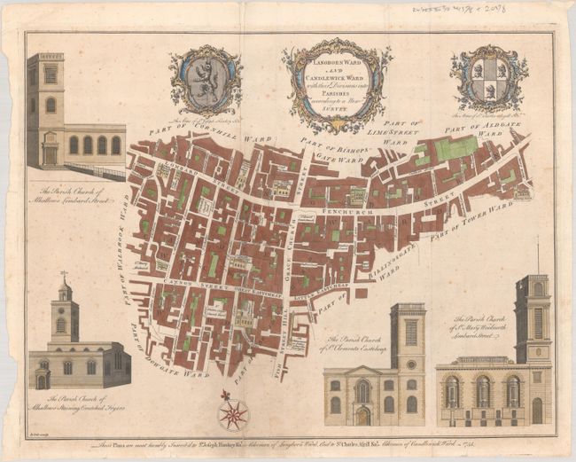
These copperplate engravings were published in William Maitland's History and Survey of London, 1756. They are very detailed maps of the streets, lanes, alleys and courts in the ancient city of London. They are richly embellished with architectural profiles of major churches or important buildings, the arms of the mayor and aldermen, elaborate title cartouches and compass roses.
This attractive plan depicts the wards of Langbourn and Candlewick with architectural profiles of the churches of All Hallows Lombard Street; All Hallows Staining; St. Clements, Eastcheap; and St. Mary Woolnorth. The plan is further embellished with an ornate title cartouche, two coats of arms, and a compass rose.
References:
Condition: B
A crisp impression issued folding with "VI" and fleur-de-lis watermarks. There is scattered foxing, minor creasing, and a 4.5" fold separation at lower left that has been closed on verso with old paper. A number of short edge tears in the bottom margin have also been closed with archival material on verso.