Subject: London, England
Period: 1741 (dated)
Publication:
Color: Hand Color
Size:
22.1 x 19.1 inches
56.1 x 48.5 cm
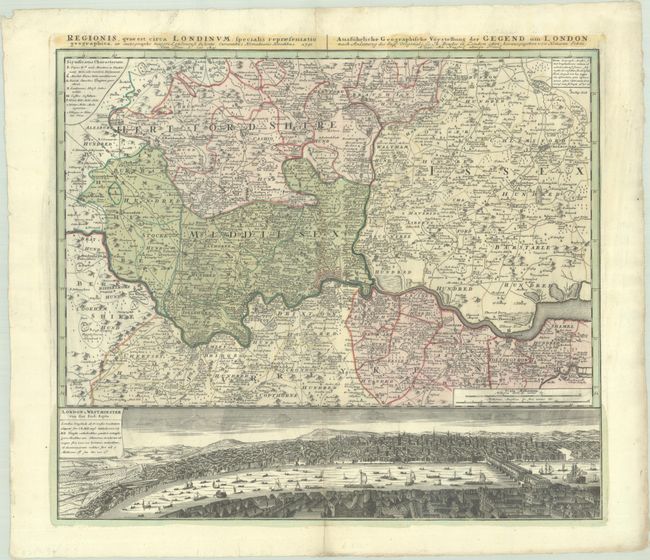
This very detailed map centered on London was originally produced by Thomas Bowles. It covers the vicinity from Maidenhead to Rochester. The map extends to include P. High Wickham, Chelmsford, Bishops Stratfort, and below Rochester. The lower quarter is a bird's-eye view of London and Westminster from Southwark from across the Thames, which is densely filled with boats and ships of all description. The legend uses icons to locate towns, market towns, parish churches, gentlemen's houses, castles, wind and water mills, and villages.
References: Howgego #88.
Condition: B+
A sharp impression with full contemporary color, a bit of printer's ink residue, and a couple of tears adjacent to the centerfold that have been archivally repaired on verso. The sheet is deckle-edged and there are a few short creases at top. There is a previous owner's stamp on verso.