Subject: Eastern England
Period: 1645 (circa)
Publication: Le Theatre du Monde ou Nouvel Atlas
Color: Hand Color
Size:
19.6 x 15.4 inches
49.8 x 39.1 cm
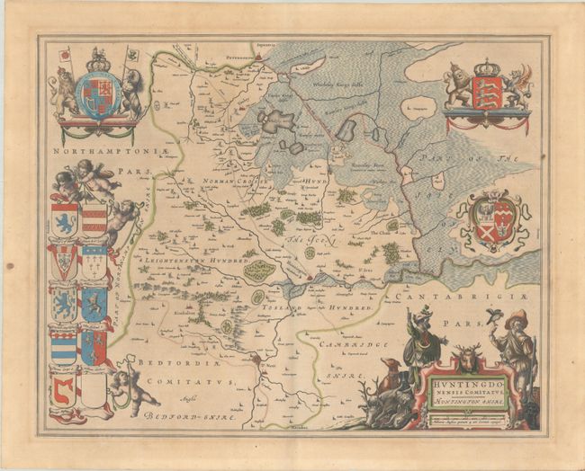
Lovely map of Huntingdonshire that is based on John Speed's earlier depiction. The northeast quadrant of the county is graphically depicted as a vast marshland. The town of Huntington is near the center, Peterborough is at top, Kimbleton is to the left and St. Neot is at the bottom. The map is supremely decorative with a beautifully engraved cartouche surrounded by two hunters and the accoutrements of their sport, including dogs, a falcon and passel of game. There are no less than twelve armorial crests surrounding the map, including the royal coat of arms. French text on verso, published between 1645-48.
References: Van der Krogt (Vol. II) #5305:2.
Condition: B+
A crisp impression on a lightly toned sheet with several small paper flaws that have caused dark spots, one of which has resulted in a tiny hole adjacent to St. Neot.