Current Auction
Lot 388
Current Auction

"Smith's New Map of England and Wales, with Part of Scotland, Including the Turnpike, and Principal Cross Roads, the Course of the Rivers, & Navigable Canals...", Smith, Charles
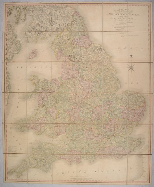
Subject: Britain

Period: 1806 (dated)

Publication:

Color: Hand Color

Size:
37.1 x 45.5 inches
94.2 x 115.6 cm
Download High Resolution Image
(or just click on image to launch the Zoom viewer)

This large folding map of England, Wales and southern Scotland is filled with detail including turnpike roads, postal roads, canals and churches. Distances between towns are noted in English miles. Topography is graphically depicted by hachure. Dissected into 36 segments and backed with linen. Published for C. Smith, Mapseller 172 Strand.

References:

Condition: B+

Contemporary color with some light toning and offsetting. Dissected and backed with linen.

Estimate: $200 - $230

Current High Bid:
$0

Reserve: Reserve Not Met
Next Bid: $100

Bid Increments
$100 - $249$10
$250 - $499$25
$500 - $999$50
$1,000 - $2,499$100
Terms & Conditions