Catalog Archive
Auction 206, Lot 379
"Carte Generale de Toutes les Routes de Postes d'Europe Dresse et Publiee par des Officiers de l'Etat Major de l'Ancienne Armee Polonaise", Picquet, Charles
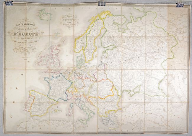
Subject: Europe
Period: 1835 (dated)
Publication:
Color: Hand Color
Size:
52.5 x 36.6 inches
133.4 x 93 cm
Download High Resolution Image
(or just click on image to launch the Zoom viewer)
(or just click on image to launch the Zoom viewer)