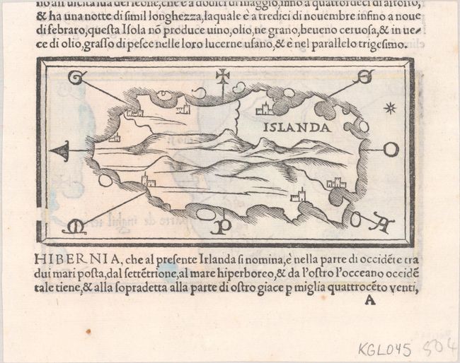
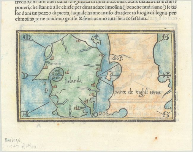
Subject: Iceland & Ireland
Period: 1547 (published)
Publication: Isolario
Color: Black & White
Size:
5.8 x 3.4 inches
14.7 x 8.6 cm
Extremely early and scarce woodcut map focuses on Iceland with east oriented at top, a mountainous interior and a few unnamed cities along the coastline. It is the first separately printed map to center on Iceland. An equally fascinating map of Ireland and part of the coast of England and Wales is on the verso, which is considered the earliest map focused on Ireland. Bordone's Isolario was one of the earliest and most important works of its time. It is remarkable for being the first atlas covering the entire world not based on classical geography, but rather on contemporary information. Bordone was an illuminator and wood-engraver, working in Venice, when he was given permission by the Senate to print maps of Italy and the world. None of those maps have survived and his only remaining works are the maps from the Isolario (Island Book). On a trimmed sheet of Italian text.
References: King (3rd ed.) #1528a.
Condition: A
Nice impressions on a bright sheet with two small spots in the bottom margin. The map of Iceland is black & white, and the map of Ireland has modern hand color.