Current Auction
Lot 368
Current Auction

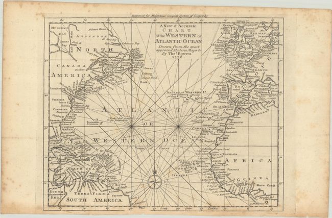
"A New & Accurate Chart of the Western or Atlantic Ocean Drawn from the Most Approved Modern Maps &c.", Bowen, Thomas
Subject: North Atlantic Ocean

Period: 1778 (dated)

Publication: Middleton's Complete System of Geography

Color: Black & White

Size:
10.6 x 8.5 inches
26.9 x 21.6 cm
Download High Resolution Image
(or just click on image to launch the Zoom viewer)

This finely engraved small chart centers on the Atlantic, including a small part of South America, the Caribee Islands, Newfoundland and Labrador, and western Africa and Europe. There are several place names along the Eastern Seaboard as it existed during the Revolutionary War. The map is crossed with rhumb lines and adorned with a simple compass rose.

References: McCorkle (18th C. Geography Books) #280-14 (Vol II).

Condition: B

A crisp impression with light foxing.

Estimate: $140 - $170

Current High Bid:
$0

Reserve: Reserve Not Met
Next Bid: $70

Bid Increments
$50 - $99$5
$100 - $249$10
$250 - $499$25
$500 - $999$50
Terms & Conditions