Subject: Cayenne, French Guiana
Period: 1753-64 (circa)
Publication:
Color:
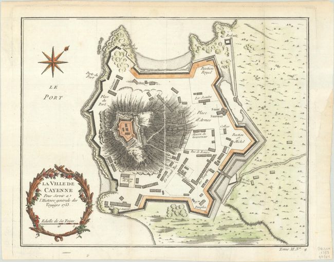
A. La Ville de Cayenne pour Servir a l'Histoire Generale des Voyages, from Histoire Generale des Voyages, dated 1753, hand color (10.9 x 8.8"). Detailed plan of the fortified city held by the French, but twice captured by the Dutch in the 17th Century. It later became a French penal colony for nearly a century. This example shows the hospital, church and names several roads. The map is decorated with a floral title cartouche and a compass rose orienting the map to the northwest. Condition: A crisp impression, issued folding with light toning in the top margin and a binding trim at right that has been replaced with old paper. (A)
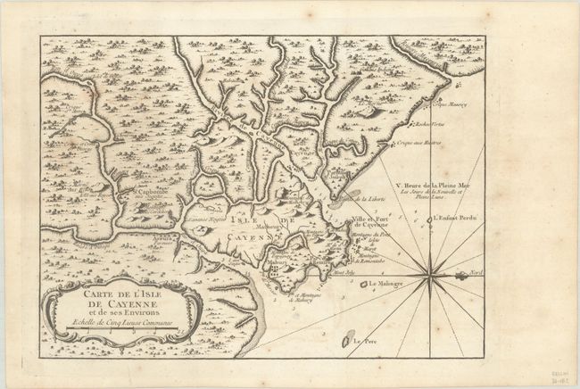
B. Carte de l'Isle de Cayenne et de ses Environs, circa 1764, black & white (11.3 x 8.2"). This nicely engraved chart covers the natural harbor of Cayenne and its surroundings in French Guiana. There is nice detail of the region's watershed and topography. Soundings and rocks appear in the water. Condition: A nice impression, issued folding on a watermarked sheet with light toning and scattered foxing. (B+)
References:
Condition:
See description above.