Subject: Southern United States, Mexico & Central America
Period: 1747 (published)
Publication: A Complete System of Geography
Color: Black & White
Size:
16.7 x 13.9 inches
42.4 x 35.3 cm
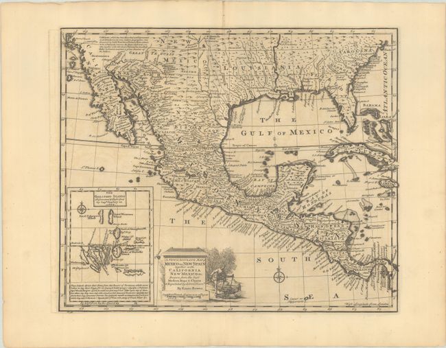
This nicely engraved map covers the region from California to South Carolina, as well as all of Mexico, Central America, Cuba, and Jamaica. A descriptive legend in southern California gives credit to Father Kino for discovering that California is a peninsula rather than an island. There are a number of settlements along the Rio Grande as well as Cenis Fort and several settlements in Texas. Inset at the lower left features a great little map of the Galapagos Islands, including some interesting notes on their discovery in 1684 and the origin of the name. The title cartouche features a vignette of a man subduing a pair of natives.
References: McCorkle (18th C. Geog. Books) #17-27 (Vol II); Shirley (BL Atlases) T.BOW-2a #57; Wheat (TMW) #126.
Condition: B+
A dark impression with a Lubbert van Gerrevink watermark. There is light offsetting, a printer's crease at top, and a short centerfold separation in the bottom blank margin.